usda cdl CDL
rslearn.data_sources.usda_cdl.CDL
This data source is for the USDA Cropland Data Layer.
The GeoTIFF data will be downloaded from the USDA website. See https://www.nass.usda.gov/Research_and_Science/Cropland/SARS1a.php for details about the data.
There is one GeoTIFF item per year from 2008. Each GeoTIFF spans the entire continental US, and has a single band.
Configuration
{
  "class_path": "rslearn.data_sources.usda_cdl.CDL",
  "init_args": {
    // Optional timeout for HTTP requests.
    "timeout_seconds": 10
  }
}
Available Bands
The data source yields one band, and the name will match whatever is configured in the band set. It should be uint8.
At https://www.nass.usda.gov/Research_and_Science/Cropland/metadata/metadata_CDL24_FGDC-STD-001-1998.htm it shows the meaning of the band values (search for "Categorization Code").
Example
Here is an example data source configuration:
{
  "layers": {
    "cdl": {
      "band_sets": [{
          "bands": ["cdl"],
          "dtype": "uint8"
      }],
      "data_source": {
        "class_path": "rslearn.data_sources.usda_cdl.CDL"
      },
      "type": "raster"
    }
  }
}
Save this to a dataset folder like /path/to/dataset/config.json. Then we can create a
sample window, and then run prepare/ingest/materialize.
export DATASET_PATH=/path/to/dataset
# This will create one 1024x1024 window at 10 m/pixel, which matches the Sentinel-2
# resolution. We pick an area with several crop fields.
rslearn dataset add_windows --root $DATASET_PATH --group default --name my_window --box=-122.131,47.905,-122.131,47.905 --src_crs EPSG:4326 --window_size 1024 --utm --resolution 10
rslearn dataset prepare --root $DATASET_PATH
rslearn dataset ingest --root $DATASET_PATH
rslearn dataset materialize --root $DATASET_PATH
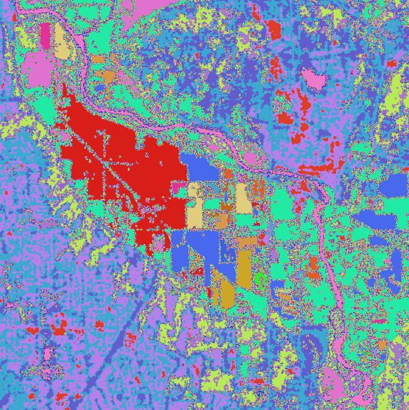
You can then visualize the image in qgis: